
|
|
Qu'Appelle Valley Geolog Stop 2
- Valley View
[ Previous Stop ] [ Next Stop ] 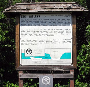
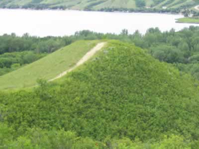
Stop 2 is found inside Echo Valley Provincial Park, up the hill and across the highway from Stop 1. It is located on a point on the south side of the valley that overlooks Sioux Crossing, Pasqua Lake and Echo Lake. Echo Lake Provincial Park was built in 1960 and was one of the first provincial parks to be built in the province. A lot of development of the area was needed before the park was opened to the public, including the construction of artificial beaches. In order for the beaches to be constructed, a large amount of sand was used to fill parts of Echo Lake and the marshes of Sioux Crossing. Unfortunately the filling of Sioux Crossing destroyed an important natural fish spawning habitat, diminishing the levels of fish in the region for a time. Currently Stop 2 is a sandy knoll, with very typical Saskatchewan flora. There are plenty of Saskatoon and Chokecherry bushes, grasses, and wild prairie flowers. The west side of the slope is exposed to the elements and is very dry. Local residents have grooved out a mountain bike trail that winds from the top of the hill around to its base. The east side of the hill is more moist than the west side, and drains into a gully that stretches all the way to the base of the hill. Geology The Qu'Appelle Valley is actually three valleys in one - with the advancement and subsequent melting of glaciers, the valley area that is now Qu'Appelle has been cut, filled, and covered twice before. The first of these valleys was the Hatfield Valley. It was cut 68.6 million years ago (mya), and was subsequently filled and covered. After this, the area was cut again to form the Muscow Valley. After 18,000 years, the Muscow Valley was filled and covered. Finally, 15,500 years ago, the Qu'Appelle area was cut by still another glacier, and 14,000 years ago the glacier melted. It left behind a unique valley which cuts through the Saskatchewan landscape. However, as with all valleys, the Qu'Appelle Valley is also in the process of being filled. Aerial Photo Click here to see an aerial photograph of stop 2.
Plant species found at stop 2: |
Page last updated on
2004-10-08 |