|
|
Maps & Aerial Photographs
Click on the thumbnails to see larger versions of the maps and aerial photos.
Maps

Aerial Photos
The aerial photos on this page were donated by Information Services Corporation, located in Regina Saskatchewan. Three of these photos are actually three or more pictures in one - they have been joined together in one image to present a high-level (between 36,000 and 60,000 feet) overview of the Qu'Appelle region.
The first of these mass photos, taken in 1958, shows the Qu'Appelle region prior to construction of Echo Valley Provincial Park and before much urbanization occurred in the area. In order to build the provincial park the province altered a large amount of the natural water line around Stop 12 to make the beach more appealing to tourists. You will see the difference between Stop 12 in 1958 and the two later photos as the area does not appear as jagged as it did before. Unfortunately, while filling the Stop 12 area with sand, a major fish spawning area was lost. Fortunately this has been accommodated for by the Fort Qu'Appelle Fish Hatchery.
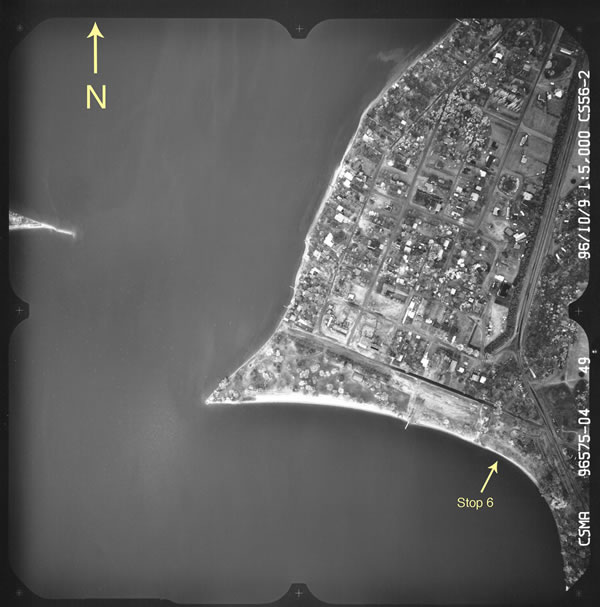
The second mass photo was taken in 1978. In this set further development of the town of Fort Qu'appelle has occurred, along with expansion and development of Stop 6, Katepwa Provincial Park.
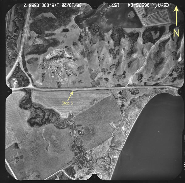
The third mass photo, the most recent high-level photo provided for us, was taken in 1990. To the untrained eye the terrain in this photo does not look much different than the two previous ones, but upon closer inspection a few differences are noticeable. The town of Fort Qu'Appelle has grown again, as has the town of Lebret (Stops 4 and 5). Katepwa and Echo Valley Provincial Parks have both been further developed and expanded, and a new road by Stop 5 was built in the late 1970s to accommodate higher traffic in the Valley. Regrettably more visitors and residents enjoying the Qu'Appelle region means that new roads further alter the landscape and many natural habitats of plants and animals are destroyed.
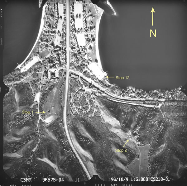
The last four photos are low level (5,000 feet) close-up photos of Stops 1, 2, 3, 5, 6, 8 and 12. These photos offer a more intimate look at the terrain of the Qu'Appelle region and its unique features. Be sure to read about the geology of these Stops in the Stop description pages, and then see if you can find the features yourself!
You can download ER Viewer which you can use to view, zoom, and measure the mass aerial photos, or go to www.ermapper.com to get it from the original source.
After installing ER Viewer, download the mass aerial photos from1958, 1978, and 1990, or click on the images below to see larger versions of the aerial photographs from some of the tour stops. If you want, you can also view these smaller pictures with ER Viewer if you want a closer look!


|